Background
Background
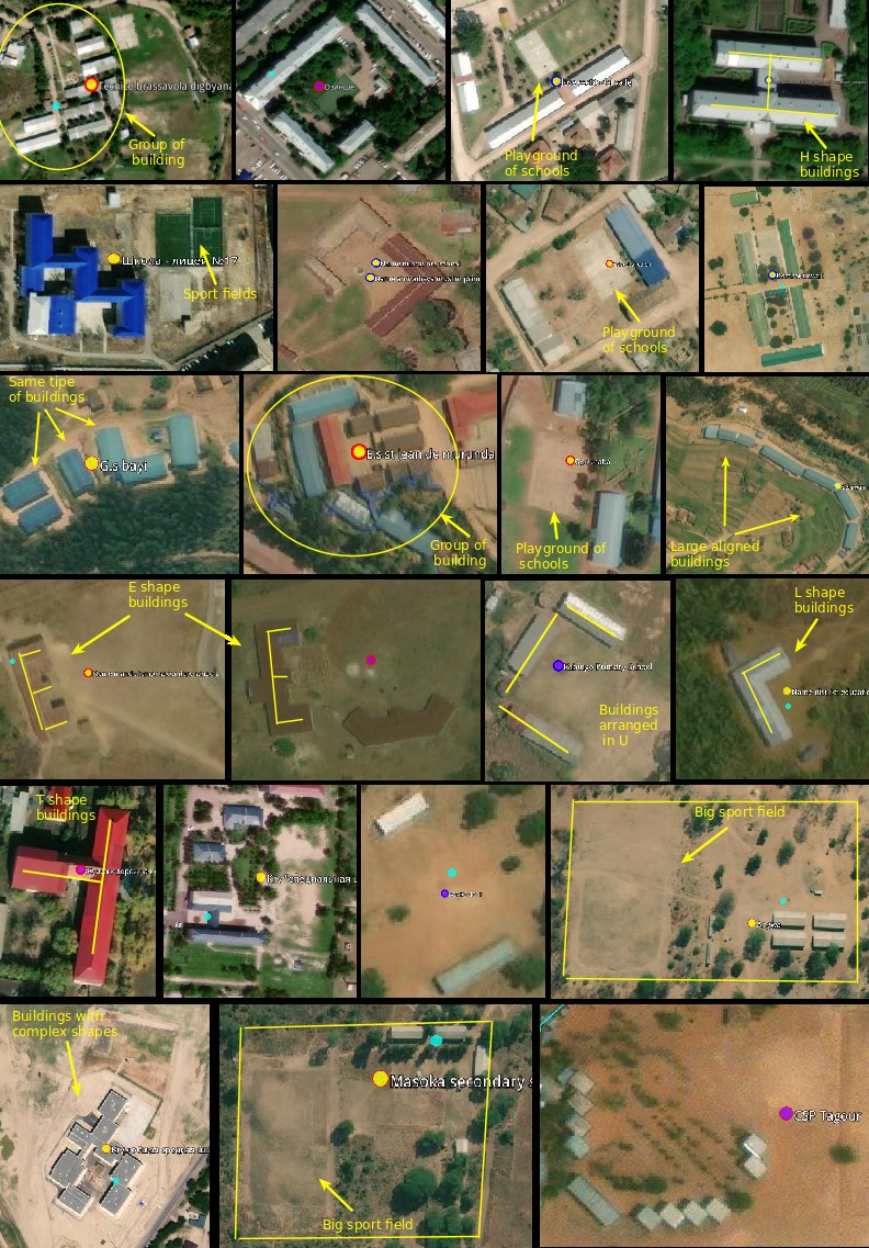
Accurate data about school locations is critical to provide quality education and promote lifelong learning, listed as UN sustainable development goal4 (SDG4), to ensure equal access to opportunity (SDG10) and eventually, to reduce poverty (SDG1). However, in many countries, educational facilities’ records are often inaccurate, incomplete, or non-existent. An accurate, comprehensive map of schools - where no school is left behind - is necessary to measure and improve the quality of learning. Such a map, in combination with connectivity data collected by UNICEF’s Project Connect initiative, can be used to reduce the digital divide in education and improve access to information, digital goods, and opportunities for entire communities. In addition, understanding the location of schools can help governments and international organizations gain critical insights into the needs of vulnerable populations, and better prepare and respond to exogenous shocks such as disease outbreaks or natural disasters. Despite their varied structure, many schools have identifiable overhead signatures that make them possible to detect in high-resolution imagery with modern deep learning techniques (Figure x). Our past projects with the UNICEF Office of Innovation have demonstrated Convolutional Neural Networks (CNNs) can successfully identify and locate unmapped schools in high-resolution imagery. We believed that the digital signature of schools from overhead imagery can be activated and recognized well across geo-diverse landscapes within a country or even among countries. In this project, six individual country models, two regional models (East and West African models), and a global model were developed. What makes school as a school from the overhead imagery is the distinguishing school features. These features include signature building size, shape, rooftop materials and colors, building complex and (or) sports fields, basketball/football fields, etc.
We successfully trained a binary school classifier, a pre-trained Xception model, with existing and cleaned schools dataset by DevSeed Data Team5, and was able to map nearly 11,000 schools in Colombia and 11 Eastern Caribbean nations in 2019. Such an application was continuing its mission to detect and map schools in 8 high-impact but lower-income countries in 2020 and 2021 under the UNICEF GIGA mission by the Development Seed team.
__________________________________
4 "UN Sustainable Development Goals." https://sdgs.un.org/goals. Accessed 16 Feb. 2021.5 "DevSeed-Data - OpenStreetMap Wiki." 8 Nov. 2019, https://wiki.openstreetmap.org/wiki/DevSeed-Data. Accessed 17 Feb. 2021.